Overview
Ask anything about this home
Pricing, comps, HOA, the neighborhood. Answers before you fill out anything.
About this home
Johnson Ave E is a home Haines City. Flood zone AH - confirm flood insurance requirements with your lender.
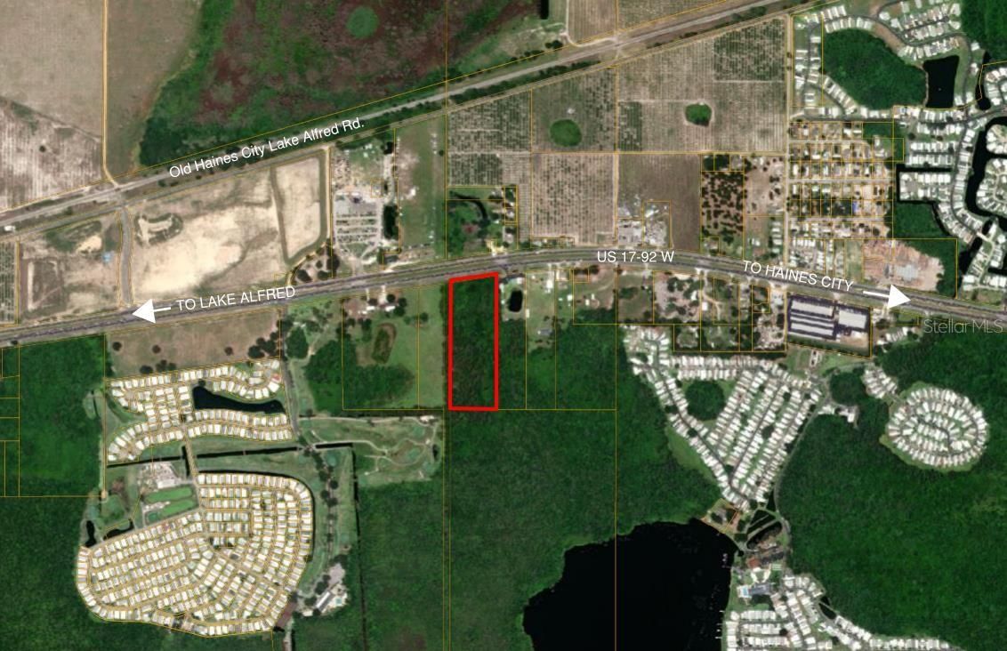
Lots 27-27-27-000000-031050, 27-27-27-000000-033060,27-27-27-000000-033070,27-27-27-000000-033080, and 27-27-27-000000-033190. All specified parcels are located within the agricultural residential rural future land use district (A/RR). The purpose of the A/RR district is to provide lands for the continuation of productive agricultural uses and to provide for very low-density residential development within unincorporated rural areas. The A/RR district permits agricultural activities, agricultural support facilities, multi-family dwelling units, farm labor housing, group living facilities, and community facilities. According to the Polk County GIS Viewer, the parcel appears to have wetlands and is entirely a Special Flood Hazard Area. Development is regulated in accordance with the land use standards of the Polk County Comprehensive Plan and Land Development Code. It is recommended that the property owner obtain a wetland delineation to verify wetland boundaries and contact a real estate attorney for an opinion of title. If the parcel was created after December 1, 1993, the parcel may be accompanied by a deed restriction prohibiting development. If the parcel was created on or before December 1, 1993, development is required to meet a 25 ft setback from any wetland boundary. In the event application of that requirement precludes use of the property, development of one dwelling unit may be allowed. If the unit is located partially or entirely within a wetland, the development is subject to wetland impact review by the Florida Department of Environmental Protection or Southwest Florida Water Management District. The density in this land use district is one dwelling for every 5 acres. The property is eligible for a single-family residence, modular or manufactured/mobile pending the issuance and finalization of a building permit. Planner on Call is an able to offer general guidance regarding the Land Development code, staff are not able to assist with detailed inquiries. Due to the complex nature of the information being requested staff strongly recommends a pre-application meeting to discuss your intent. Attached are step-by-step instructions for applying through the Accela Citizen Portal. The cost is $250.00 and it takes approximately 3 to 4 weeks to schedule the meeting. The Development Review Committee includes members of staff from Planning, Engineering, Roads and Drainage, Fire Services, and Utilities who can provide comments on how to proceed with your request. This information was provided by email from Planner on Call. Buyer to do their own due diligence.
Request documents
Free. Tap one and our team sends it over.
The essentials
At a glance
Payment
Details
Taxes reflect the most recent assessment in the MLS feed. Actual tax owed can vary, so confirm with the county property appraiser before closing.
Price history
Neighborhood
Calculator
Not sure what you can afford?
Put in your household income and we will tell you where this payment sits.
Property taxes are this home's actual annual bill from the MLS, divided by twelve. Insurance estimated at 0.60%. Rate defaults to 6.8% on a 30-year fixed. Tap a pencil to use your own numbers. Estimates only, not a loan quote.
Quick answers.
Price
$950,000
Time on market
84 days
Monthly payment
About $5,483/mo
That is 20% down on a 30-year fixed at 6.8%, plus the home's $640 annual tax bill, insurance.
Flood zone
Zone AH
That is a high-risk designation, so a lender will normally require flood insurance. Confirm the current rate before you write an offer.
Have another question?
Keep exploring Florida
Pick up where you left off, or see what else is out there.